Process. Analyze. Share
Remote Sensing & GIS are vertical growing science and technology. It serves the industrial and environmental purpose, which includes creating Social awareness and Economic Changes. However, there are still many sectors who are either not using these technologies or there is a demand for implementation.
Considering the good will of these technologies, Geoinfra Technologies India has been commenced to provide the Turnkey Solution through Information Technology.
Get It Done By Geospatial Experts
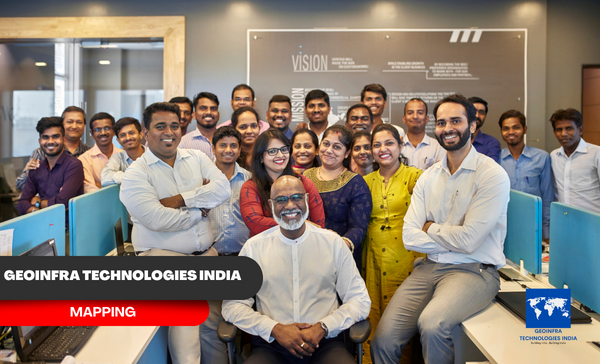
Our colleagues are our major strength, which means our clients benefit from a well-trained, conscientious, and diligent work force. Our people can resolve the most un-presidential geo-spatial challenges for our clients. In addition, more than half of our colleagues have certifications in their respective domain areas.
Cost Effective Solution
Our cost-effective solutions are designed to help businesses save money without compromising on quality. We understand that every business has different needs and budgets, which is why we work closely with our clients to develop a tailored solution that meets their specific requirements.
We Believe In Quality
We understand that our customers expect the best from us, and we are committed to delivering products and services that meet or exceed those expectations. Quality is not just a buzzword for us; it is a core value that guides everything we do.
On Time Deliveries
At our company, we understand that time is of the essence. That’s why we are committed to delivering our data on time, every time. We know that our customers rely on us to meet their deadlines, and we take that responsibility very seriously.
Services
We are providing top-notch services in geospatial industry. Geospatial services refer to the collection, storing, processing, analysis, and presenting geographic data for the solutions. This data can be used to transmogrify decision-making process across a range of industries, from urban planning and environmental management to defense and transportation.
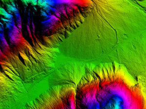
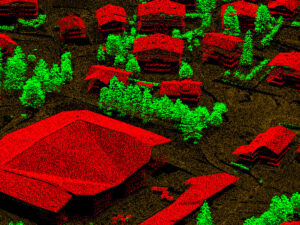
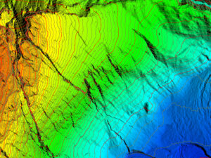
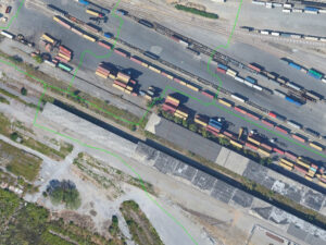
Lidar
GeoInfra Technologies India specializes in offering LiDAR data processing solutions to a wide range of industries, boasting a team with a wealth of experience in managing both national and international projects encompassing ALS, MLS, and TLS data processing.
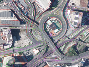
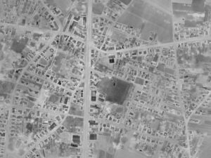
Photogrammetry
GeoInfra technologies India offers comprehensive services in aerial photography and satellite imagery, catering to a range of scales for topographic and planimetric mapping needs, with a specialization in producing precise 3D models.
Image processing
GeoInfra Technologies India specializes in offering LiDAR data processing solutions to a wide range of industries, boasting a team with a wealth of experience in managing both national and international projects encompassing ALS, MLS, and TLS data processing.
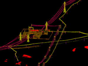
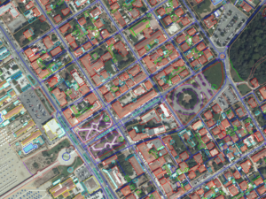
GIS & CADD
GeoInfra Technologies India offers comprehensive GIS and CADD services to diverse industries, seamlessly integrating remote sensing and mapping capabilities, and providing valuable support for various analytical initiatives.
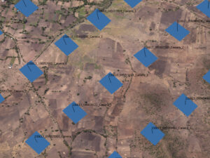
Drone processing
GeoInfra Technologies India provides capturing high-resolution images and then applies advanced data processing techniques to extract valuable insights and information. This service is employed across various industries.
BIM Technology
GeoInfra Technologies India provides comprehensive service that leverages advanced digital tools and methodologies to enhance the design, construction, and operation of buildings and infrastructure projects.
Industry Expertise
At GeoInfra Technologies India, we extend our services to a diverse array of industries, leveraging our wealth of expertise and experience. Our team of dedicated professionals is unwavering in its commitment to providing tailored solutions that precisely address the distinct requirements and challenges inherent to each industry. The following is an enumeration of some of the industries within our purview.
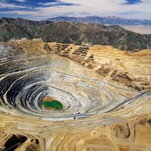
MINING MANAGEMENT

UTILITIES MANAGEMENT
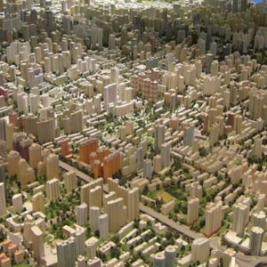
URBAN PLANNING AND MANAGEMENT
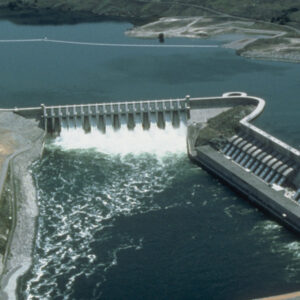
HYDROLOGICAL APPLICATIONS
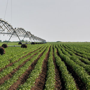
AGRICULTURE MANAGEMENT

FOREST MANAGEMENT
Portfolio
As seasoned professionals in the geospatial industry, our dedication lies in harnessing spatial data to address intricate challenges and facilitate well-informed decision-making process. Our extensive experience spans a wide spectrum of geospatial services, encompassing GIS, remote sensing, cartography, surveying, geospatial analysis, data management, and geocoding. Our track record underscores our unwavering commitment to precision, meticulous attention to detail, and a steadfast focus on delivering top-tier solutions to our clients.